UAV Photomonitoring – WSDOT SR 14 Post-Wildfire
Issue
A wildfire of approximately 10,000 acres burned the slopes above SR 14 at milepost 69, leaving them unstable and prone to rockfalls. The highway was closed due to the high hazard level. WSDOT needed a rapid, remote method to assess post-fire slope stability and guide safe reopening. Due to the large extent of the area to be monitored and the fire-related hazard for humans, remotely piloted UAV were elected as the most suitable acquisition platforms.
Solution
NHAZCA provided UAV-based Photomonitoring™. Drone imagery was collected over the affected area (July 22, 2025) and processed with IRIS software for image coregistration and change detection. The service compared the new dataset against a pre-fire acquisition to:
- Detect rockfall events and unstable sectors.
- Map debris movements (loose material mobilized downslope).
- Identify zones directly affected by fire damage.
Achievements
The change detection maps delivered to WSDOT provided objective, visual evidence of slope evolution after the wildfire. By highlighting rockfall source areas, debris flow paths, and fire-impacted zones, the service supported hazard evaluation and risk mitigation planning. This remote approach reduced the need for on-slope inspections and demonstrated how UAV Photomonitoring™ can strengthen emergency geohazard management even for large/difficult to access areas.
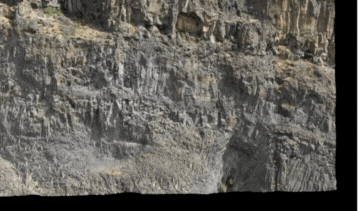
Example of co-recording of the monitored scenario carried out by IRIS
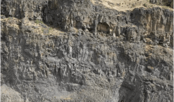
Original images captured by drone, not co-registered
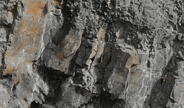
Detail of a rockfall phenomenon correctly identified by Photomonitoring technology